


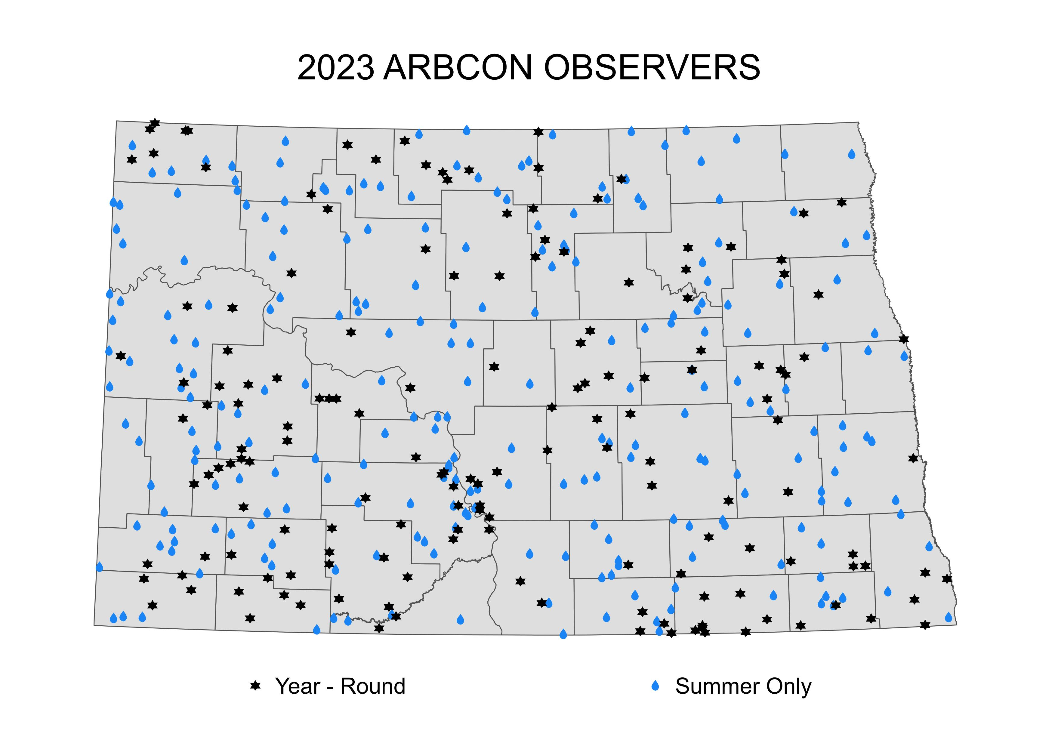
ARBCON Locations
The ARBCON is comprised of nearly 400 volunteer observers across the state of North Dakota. Since 1977, observers have recorded daily rainfall and hail occurrences at their locations for the months of April through September of each year. Starting in October 2010, some observers began snowfall reporting, thus making the network operational on a year-round basis.
Resources
ARBCON reports are all available to be viewed or downloaded through the mapping and data resources on this site. Map Services are a variety of internet map servers with various themes. Our general map service uses our vast data resources such as water data locations, drillers’ logs, aquifers, and precipitation information to integrate with spatial data holdings including aerial photography, geo-political boundaries, transportation, and hydrographic features. Our specialized map services are designed for specific data sets. We also have specialized map services related to the data they are designed to deliver such as the LiDAR map service, survey map service, and an aerial imagery map service. Click this link to go directly into the Map Services or click this link to chose presets designed for specific data sets, such as Precipitation Information.
The Precipitation Data page allows you to download data by county, latitude and longitude, or by individual Site ID number.
The Interactive Precipitation Mapping page is a mapping resource for quickly displaying ARBCON data.
The Precipitation Maps Archive page allows you to view jpg files of monthly and yearly precipitation maps from 1977 through the present.
30 Year Average Maps Archive - The conclusion of the 2006 growing season completed a 30 year continuous record of precipitation during the growing season in North Dakota. This has led to the completion of average rainfall maps for each month and the growing season as a whole.
If you are interested in becoming a precipitation observer in your area, please email the following information to the highlighted link below or call us at 701-328-2788 or 1-800-654-5981.
- Name
- Address
- Phone Number
Hall of Fame
ARBCON Hall of Fame is a list of observers (active and inactive) who have reached or surpassed 30 years of volunteering!
49 Years
- Boehm, Keith
- Brickner, Alan
- Folkvord, Ross T
- Gartner, Leona
- Hardesty, Patty
- Havelka, Gerald
- Hochhalter, Barbara
- Lapica, Jeff
- Law, James
- Miller, Eugene
- Olson, Kelly D
- Pieterick, Larry
- Richter, David
- Roffler, Malcolm
- Schulz, James
- Voigt, Andrew
48 Years
- Anderson, Larry
- Braun, Becci
- Burbidge, Theresa
- Christensen, Delmer
- Dukart, Clyde
- Engraf, Ross
- Hagen, Dennis
- Knutson, Kim
- Mullen, Winston S
- Olson, Marlene
- Ova, Kevin
- Ronningen, Barry
47 Years
- Edwards, Darryl
- Netzloff, Charles
- Soderholm, Paul
- Werner, Donald
46 Years
- Cook, Mark J
- Fauske, Russell
- Fettig, Betty
- Haas, John L
- Liebelt, Darrell W
- Nord, Olaf
45 Years
- Campbell, Donald
- Hovde, Lynn
- Pope, Douglas
44 Years
- Beckstrand, Brad
- Brown, Milton
- Carter, Jimmy
- Costain, Allen
- Estenson, Jerry
- Fedje, Marshalle
- Greenlee, Billy G
- Kirschemann, Lucille
- Lincoln, Phyllis
- Miller, Loretta
- Scheffert, Madella
- Schlosser, Joe
43 Years
- Bauer, Jimmie D.
- Braaten, Marvin
- Brinkman, June
- Dollinger, Milbert
- Fisher, Bart
- Heinle, Ethel
- Hochhalter, Keith
- Kinzley, Richard & Coleen
- Klein, Oscar H
- Leichtman, Ms Joann
- Pohl, Keith
- Romfo, Dennis
- Saxberg, Arnold
- Wald, Anton A
- Williams, Lee
42 Years
- Bezdicek, Robert J
- Duhr, Dorothy
- Eichele, Geraldine
- Hoff, Lawrence
- Oster, Carolyn
- Pankow, Gerhardt
- Person, George
- Thelen, Nick
41 Years
- Erickson, Dale
- Harms, Walter
- Johnson, Marjorie
- Laine, Kathy
- Meyer, Herman
- Sayler, Rolland F
- Stenberg, Titus
- Swindler, Kerry
40 Years
- Anderson, Jill
- Dilse, Stuart
- Donaldson, David L
- Fugl, Jodi
- Gerszewski, Richard
- Hagerott, Arden
- Langton, Brian
- Luebke, Donna
- Meier, Paul
- Miller, Kenneth
- Porter, Ronald
- Roloff, Rowen
- Schmaltz, Nicholas
- Tachenko, Terry
39 Years
- Allard, Allen
- Anderson, Lonnie L
- Arneson, Jerome
- Banderet, Robert
- Barnick, Leroy
- Bear, Donald
- Bear, Kay
- Belohlavek, Dan
- Betsch, Perry
- Breuer, Marlyne
- Dulmage, Robert
- Harwood, Susan
- Miller, David J
- Mosset, Willy
- Nitz, William H
- Steig, Leonard
- Strand, Arlyn
- Wetzstein, Bill
38 Years
- Armentrout, Rodney
- Becker, Virginia
- Carlson, Robert
- Meier, Travis
- Neubauer, Larry
- Puhr, Steve
- Scharbow, Lonnie
- Schauer, Verdun
- Ulrich, Terry
37 Years
- Bassen, Darrell
- Bonn, Brent
- Boone, Roger
- Brademeyer, Fred J
- Enderson, Arvin
- Hickle, Rodney
- Hruby, Marjorie
- Johnson, Joanne
- Knoke, Richard
- Michaels, Doris
- Olson, Ralph
- Peters, Charles
- Privratsky, Steven M
- Rosenau, Gary
- Ternes, Seferious
36 Years
- Akin, Melissa
- Bergh, Jon & Glenda
- Bliss, David
- Boe, Bruce A
- Carter, Mardella
- Dewitz, Sharon
- Eldevik, Gregory
- Kallis, Arnold
- Krein, Loren
- Miller, Margie
- Rutschke, Jerome
- Smith, Willis
- Torrance, Robert
- Wall, Arthur
- Wanner, Monica
35 Years
- Fossen, Cecil
- Galbreath, Wyman
- Gebeke, Greg
- Gravseth, Lyle
- Jacobson, Eunice G
- Jones, Todd
- Lien, Nels E
- Presler, Walter H
- Tomac, Frank
34 Years
- Anderson, Caroline
- Beeson, Michael
- Borner, Lavonne
- Boyko, Maynard
- Brodehl, Jeanette
- Craft, Caroline
- Faul, Allen W
- Filipi, Tillie
- Flaa, Steiner
- Frieze, John
- Greer, Gordon G
- Hoselton, Sharland
- James, Ben
- Jangula, Kathy G
- Klindt, Agnes
- Koehn, Arvel
- Lee, Harlan
- Mau, Shari M
- McIntosh, Bradley
- Ness, Lyle R
- Njos, John Lee
- Olson, Celia
- Perkins, Lloyd
- Ronningen, Clara
- Roorda, Kevin J
- Sauer, Mrs John
- Schriefer, Robert
- Slaubaugh, Denton
- Waswick, Lyle
- Weber, Dennis
33 Years
- Anderson, Mark
- Foster, Allen
- Glovich, Sandra
- Kram, Curt
- Miller, Warren
- Moses, Rosemary
- Pietsch, Elvin
- Prochnow, Charles
- Sand, Jerry
- Sharp, Ron
- Sorby, Kermit
- Vogel, Shirley
- Wolf, Lavern A
32 Years
- Bobb, Milton
- Bosch, Jerome C
- Dix, Lena
- Halverson, Marvin
- Johnson, Ardith
- Johnsrud, Doug
- Klein, Daryl
- Lykken, Lee
- Meberg, Luther
- Poleschook, Ardella
- Schauer, Elta O
- Schmaltz, Paul
- Schweitzer, Amelia R
- Smith, Warren
- Vogel, Shirley
- Warner, John
31 Years
- Aarseth, Terry
- Anderson, Mary L
- Brudevold, Russell
- Duke, Dwight J.
- Goetz, Victor G
- Goter, Arvin
- Hanson, Michael
- Hattel, Robert J
- Heley, Wayne
- Hellandsaas, Orville
- Hintz, Elvera
- Kanski, Nick
- Kurtz, Carol
- Lowman, Jim
- Randall, John
- Schultz, Herbert L
- Steffan, Gary
- Tompkins, Donna
- Zerr, Allen R
30 Years
- Adams, Jerry
- Anderson, Jane
- Brezicka, Dennis L
- Daley, Mitch
- Dekrey, John E
- Ekman, Karen
- Flynn, Eldean
- Hagerott, Marlene
- Hochhalter, Alice
- Jacobson, Terry
- Jurgens, Linda
- Lillibridge, Robert
- Loeb, Amy
- Melvin, Hattie
- Mork, Ella
- Nienhuis, Ronald
- Pfeifer, Mark
- Sonsalla, Mike H.
- Spitzer, Julie
- Swenson, Harley
- Thompson, Earl R
- Werle, Edward
- Whitman, Irene
- Wolf, Euella
Yearly Certificates
ARBCON Yearly Certificates is a list of individuals who are being recognized for their efforts to help the ARBCON be successful! Thank you all very much!
40 Years
- Anderson, Jill
- Dilse, Stuart
- Fugl, Jodi
- Gerszewski, Richard
- Roloff, Rowen
- Schmaltz, Nicholas
- Tachenko, Terry
30 Years
- Adams, Jerry
- Brezicka, Dennis L
- Jacobson, Terry
- Melvin, Hattie
- Nienhuis, Ronald
- Pfeifer, Mark
- Sonsalla, Mike H.
- Spitzer, Julie
- Swenson, Harley
20 Years
- Carlson, Elaine
- Eldridge, Joan E
- Hofer, John
- Jahner, Gerald J
- Lange, Beth
- Linrud, Lyle
- Lovdahl, Bruce M
- Oakland, Todd
- Olson, Natanya
- Olson, Paul
- Rebel, Mischelle
- Sondreal, Kevin
10 Years
- Beierlein, Mary
- Gregor, David
- Omlid, Robert
- Schneider, Michael