


The Department of Water Resources (DWR) (formerly Atmospheric Resource Board) has been involved in weather modification research since its creation by the legislature in 1975. Weather modification research in North Dakota, however, goes back to research pilot programs that were conducted over parts of western North Dakota during the 1960s. Many advancements in cloud seeding technology, especially in the area of hail suppression have come as a direct result of research and operations in North Dakota.
North Dakota Cloud Modification Project (NDCMP) Evaluations
Since the start of weather modification regulation in 1975, a number of evaluations have been made of the effects of the program. These evaluations have been based on a variety of differing data bases. Among them are: ARBCON rainfall data, National Weather Service (NWS) rainfall data, crop hail insurance data compiled by the National Crop Insurance Service (NCIS), and wheat yield data compiled by North Dakota State University.
Computer-based numerical models have also played an important role. Economic models have provided estimates of the economic benefits of the program, while cloud models have produced increased insights into the complex processes within the clouds that ultimately govern hail and rain production. All of these evaluations have been independent, that is to say, they've been done by agencies and universities unaffiliated with the DWR, allowing the best qualified persons to do the evaluations, improving the chances for an unbiased, solid, scientific approach.
As of this date, all evaluations of the program have shown either positive or neutral results. No suggestions have been found of negative impacts, either within or outside target areas.
Michigan State University Professor Dr. Mark Skidmore and Graduate Student Scott Knowles recently evaluated the NDCMP and its effects on crop yields. Using 30 years of United State Department of Agriculture (USDA) Risk Management Agency data, their analysis sought to determine if there was any difference in crop yields (wheat and barley) and insurance loss ratios for NDCMP project counties versus surrounding counties not involved in the program.
For the 1989-2018 period, they found that average annual wheat yields in seeded counties were 13 percent higher than wheat yields in non-seeded counties. In the words of the authors, “Our evaluation indicates that the cloud seeding program had significant positive effects on crop yields and improved loss ratios.” A further analysis of economic benefits found a benefit to cost ratio of more than 36 to 1.
If you would like to read this study, you can find it at the website for the American Meteorological Society journal Weather, Climate, and Society (external link).
Two evaluations have been completed which help define the efficacy of the North Dakota hail suppression efforts. The first of these employed years of crop hail insurance data in an attempt to determine the degree of effectiveness of the hail suppression effort (Smith, et al., 1987). This study defined a control area comprised of upwind eastern Montana counties adjacent to North Dakota. Hail insurance data were analyzed for the seeded areas (target) and unseeded areas (control) showing a significant reduction of losses in the target with strong statistical significance. The significance level is an indicator of the degree of confidence which may be accorded the result of a statistical test of two populations (seeded versus unseeded, for example). The lower the numerical significance, the greater the confidence. For example, a significance level of 0.08 indicates a 92% chance that the two populations are really different, i.e., that the observed effect is real.
Claims recorded for a lengthy pre-project period from this control area were compared to those for the modern-day NDCMP target to first establish the historical relationship. Crop-hail losses accrued in both areas during the NDCMP were compared to establish the magnitude of the change. The loss ratio is the ratio of the amount of claims paid to the amount of insurance sold. Thus, a high loss ratio indicates a high hail loss. When the loss ratios for the target were plotted versus those for the upwind (west) control area for each year, a significant difference emerged between the historical years and those of the NDCMP. Sixty-one years are compared; ten for the NDCMP years (circles), and 51 years for the "historical" period which preceded the NDCMP. In Fig. 4, a single (solid) regression line is plotted for all years, seeded and unseeded. When separate lines are plotted for the seeded and historical years however, a striking difference is observed. The difference between the slopes of the Historical and NDCMP regressions can be interpreted as the change induced by seeding. In this evaluation, the NDCMP target averaged 43.5% less crop hail damage when compared to the upwind control area. The statistical confidence level for this test was .002, indicating that "...the target area loss ratio values during these [NDCMP] years were considerably lower than would have been predicted by the historical and control area regression lines". The authors of the report conclude with the observation that, "Therefore, the sponsors of the NDCMP would seem to be fully justified in continuing their support of seeding operations."
Since the completion of the Smith et al. report, an additional three years' data from the NDCMP (1986-88) were added to the original data base. In an identical analysis, the expanded 13-year NDCMP data base showed a 45% decrease in losses in the target area (Smith, et al., 1997). The findings were published in the Journal of Applied Meteorology in 1997 (external link).
Archived Report
A 2019 study from the North Dakota State University (NDSU) Department of Agribusiness and Applied Economics (Bangsund and Hodur, 2019) describes the significant economic benefits cloud seeding provides to agricultural production in the western North Dakota counties of Bowman, McKenzie, Mountrail, part of Slope, Ward and Williams. Average annual benefits for the nine crops included in the study range from $12.20 to $21.16 per planted acre for the years 2008-2017. Considering cloud seeding operations cost about $0.40 per planted acre, the benefits far outweigh the costs.
The economics of the NDCMP were evaluated based on long-term studies of the impacts of seeding on rainfall and hail. Rainfall enhancement effects were evaluated at 5 and 10 percent, which are the lower and upper bounds of typical results, while hail suppression was evaluated at a 45 percent reduction in crop loss. Impacts were computed for the eight most commonly planted crops in North Dakota plus alfalfa, which covers 96.5 percent of harvested acreage statewide on average for the study period.
Archived Reports
Some of the most important fundamental research in North Dakota took place during the North Dakota Pilot Project (NDPP), a randomized cloud seeding program conducted in McKenzie County from 1969-1972 (Dennis et al., 1975 (external link)). The NDPP found statistically-significant results that silver iodide seeding of convective clouds on a determinate set of days leads to:
- an increase in the frequency of rainfall events at the target gauges (0.04 significance level, or 96% confidence),
- an increase in the average rainfall recorded per rainfall event (0.02 significance level (98% confidence)), and
- an increase in total rainfall on the target area (0.07 significance level (93% confidence)).
Several rainfall evaluations have been conducted on the NDCMP: two looking at ARBCON rainfall data (Wise, 2005 and Tuftedal et al., 2022 (external link)) and the other at National Weather Service (NWS) climatic rain gauge data (Smith et al., 2004). The ARBCON rainfall analyses, which take advantage of hundreds of rain gauge locations in western North Dakota, indicated that between the years 1977-2003, the seeded areas and those areas slightly downwind received about 6% to 9% more rainfall than the upwind control areas where no seeding occurred (Wise, 2005). Tuftedal et al., found rainfall increases in six of nine target/control pair comparisons, with two of the ratios having a 95% statistical chance of being greater than 1.0. This is not only positive news for the seeded areas, but it also addresses the concern of some that seeding upwind will reduce downwind precipitation, or “steal someone's rain,” (e.g., DeFelice et al., 2014 (external link)). Conversely,there is no evidence that cloud seeding contributes to large increases in precipitation at long distances downwind of seeded areas. Previous studies of the NDCMP and other states' seeding programs indicate that downwind effects diminish with increasing distance from the target area. The Smith et al. (2004) study found no statistical difference in rainfall between the NDCMP counties and an upwind control area. The author concluded, however, that the sparse coverage of NWS rain gauges in both areas and the ±0.1 confidence interval would not allow the analysis to determine differences in precipitation over the two areas at a level of ten percent or less, the typical range of effect identified by several other rainfall studies.
One of the earliest evaluations of the effects of cloud seeding on summertime clouds over the plains was produced by Changnon and Huff (1972) (external link). A model was developed at the Illinois State Water Survey which projected the increases in precipitation likely to be realized by cloud seeding, based on efforts in Illinois. That model, along with projections specifically developed for North Dakota by Eddy and Cooter (1979), were used by NDSU researchers to develop an estimation of the economic benefits of the North Dakota program (Schaffner et al., 1983). This evaluation indicated that, for the six most prevalent crops in western North Dakota (wheat, oats, barley, sunflowers, corn grain, and flax), benefits from the additional one inch of rainfall obtainable by cloud seeding ranged from $3.63 to $6.21 per acre, depending upon the region of the state involved.
Another evaluation of rainfall in and near the project areas examined NWS rainfall data for seven years, 1976-82 (Johnson, 1985). Three areas were defined for each storm event: the multi-county target areas (Target), the regions downwind of the Targets (Downwind), and the areas neither in the target nor downwind (Control). Some of the more interesting findings of this analysis showed:
- Evidence of an overall increase in precipitation downwind of the target (relative to the control area), especially notable in July (15% increase, significant at the 0.08 level).
- Evidence of increase in the target areas on days with heavier rains (14% increase significant at the 0.13 level).
Lastly, daily comparisons of seeded and non-seeded rainfall in North Dakota were conducted from 1976 to 1980 (Eddy 1981). These comparisons used a dense statewide network of more than 500 rain gages and found average rainfall increases of about 15% during the June 6 to July 11 critical agricultural period. There was an increase in the number of stations reporting rain in and downwind of the seeded areas and an increase in the average rain which fell in each rain gauge.
Archived Reports
The effects of cloud seeding on urban areas in North Dakota have not been quantified. While this is an area that certainly deserves more attention, no existing dataset has yet been identified that may prove useful.
Agriculture is still a big part of North Dakota’s economy. When harvest is bountiful, those rural dollars are spent in the cities. This translates into sales of automobiles, trucks, farm implements, appliances, etc. Considerable additional tax revenue is also generated for the state and counties, which adds to those revenues from the urban areas.
The primary impact on urban areas comes in the same form as it does to rural areas – less hail, and therefore less hail damage. Fewer roofs to be replaced, fewer dents to be repaired in automobiles, fewer gardens destroyed. The damage caused by a single severe hail storm passing over a city can easily exceed millions of dollars, where payment of insurance deductibles alone removes millions of dollars from the local economy and damage drives up premiums. As an example, a large portion of the province of Alberta, incorporating the cities of Calgary and Red Deer, has been under hail suppression cloud seeding for the last 25 years to alleviate property damage from hail.
Though evaluations that attempt to statistically establish and/or quantify precipitation or hailfall are useful, the "bottom line" for the county-sponsored NDCMP is really what is obtained in terms of increased crop yields. When all is said and done, it doesn't really matter how the crop production is increased, or how the objective of less hail is achieved, it is only important that benefits are realized, and that they in fact are due to the cloud seeding program-- not chance. In an attempt to define this "bottom line", wheat yield data for western North Dakota were analyzed for the growing seasons from 1935 through 1988 (Smith et al. 1992). Figure 1 in the report best illustrates the findings of this study. The historical target-control relationship, prior to any seeding, encompasses the years 1935 - 1966, the years 1967 - 1975 (the mid years) represent years where some seeding was done in the target areas, and the years 1976 - 1988 represent the NDCMP years where seeding was conducted over all of the target area. The difference? While the historical period revealed no significant differences in yields, about 2.8% more wheat was harvested in the target areas during the mid years, while yields increased by 5.9% during the NDCMP years relative to the historical relationship. That's an additional 2 bushels per acre on a 35 bushel per acre crop.
Note that during drought years 1980, and 1988, little difference in yields is observed between the target and control areas. This comes about because droughts in North Dakota are generally characterized by a shortage of clouds having sufficient lifetimes and/or liquid water contents to produce much rain; factors which also significantly limit seedability. While the ultimate conclusion is that present cloud seeding technology cannot break a drought, the larger implication for the wheat yield study by Smith et al. is that one would not expect to observe a significant difference in yields during dry years. That implication is borne out by the data, lending additional credence to the conclusion that the 5.9% increase otherwise observed is attributable to cloud seeding. Thus, the bottom line seems to be more production in the target area, without any decrease being observed in the control areas. This is important, for it supports the observations that suggest that rainfall is not simply being redistributed. It appears that more rain is falling over a significant fraction of the state.
Archived Report
Eddy, A., and E. Cooter, 1979: The Evaluation of Operational Cloud Seeding in North Dakota: Some Preliminary Findings. Final report to the North Dakota Weather Modification Board. Amos Eddy, Inc., Norman, Oklahoma. 43p.
Johnson, J.E., R.C. Coon, and J.W. Enz, 1989: Economic Benefits of Crop-Hail Reduction Efforts in North Dakota. Agricultural Economics Report No. 247, Department of Agricultural Economics, North Dakota State University, Fargo. 26p.
Sell, R.S., and F.L.Leistritz, 1998: Economic Impact of Reducing Hail and Enhancing Rainfall in North Dakota. 29p.
Wise, E.A., 2005: Precipitation Evaluation of the North Dakota Cloud Modification Project (NDCMP). A thesis submitted to the graduate faculty of the University of North Dakota. 63p. (PDF)
Other North Dakota Supported Research
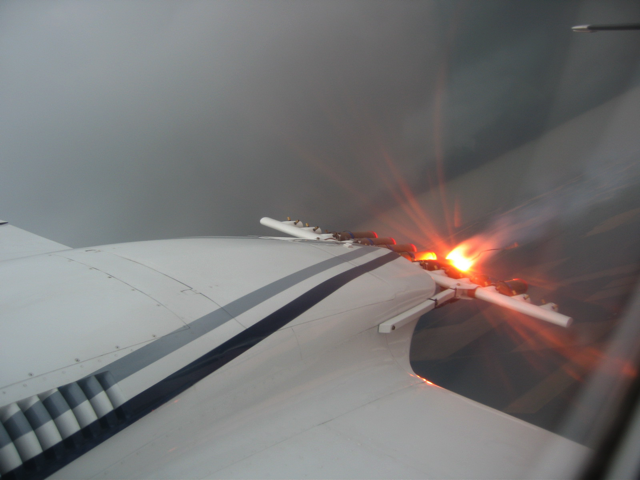
Hygroscopic flare burns below cloud
Having already conducted numerous research programs studying the benefits of glaciogenic cloud seeding (enhancing the ice process in clouds), the North Dakota Atmospheric Resource Board brought together the University of North Dakota (UND), Weather Modification Inc., and Ice Crystal Engineering in 2006 for a new kind of cloud seeding research. The Polarimetric Cloud Analysis and Seeding Test, or POLCAST, operated initially in 2006 as an exploratory field study to determine whether liquid water content was increased in clouds seeded with hygroscopic (salt) particles. Utilizing data from UND’s dual-polarimetric radar, initial indications found increases in cloud liquid water content in seven out of eight seeded cases.
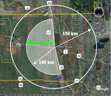
POLCAST Study Area
The results from the exploratory study prompted a more comprehensive experiment. POLCAST was re-scoped as a randomized research program over eastern North Dakota with short field campaigns in 2008, 2010, and 2012. During this multi-year field experiment, a seeding aircraft was dispatched from Fargo when atmospheric conditions were favorable for the development of convective storms within 100 kilometers of Grand Forks (see Study Area map). The aircraft remained within this close range in order to maintain the quality of radar data being collected by UND's dual polarization radar. The randomization process consisted of the radar operator drawing a sealed envelope with a "seed" or "no seed" card inside. Once a suitable cloud was located by the aircraft, the envelope was opened to reveal the decision. Neither the pilot nor radar operator knew of the decision in advance, thus eliminating selection bias. After a developing cloud was either seeded or not seeded by the aircraft, radar data continued to be collected until the cloud dissipated so that a full lifecycle was observed. A total of 33 cases (16 “no-seed” and 17 “seed”) were put through a variety of statistical analyses. Some of the more important conclusions from POLCAST field research were:
- Seeded clouds yielded 56% more rainfall than non-seeded clouds.
- Seeded clouds had longer lifetimes than non-seeded clouds (41% of seeded clouds lasted 60+ minutes, compared to 25% of non-seeded clouds).
- The rain rate in seeded clouds was higher than non-seeded clouds.
- The average raindrop size and cloud liquid water content was higher in seeded clouds.
Though all of the results indicated positive effects of hygroscopic seeding, none met accepted statistical confidence levels due to the relatively small number of cases.
In the future, the possibility exists that the NDCMP could employ hygroscopic seeding operationally for hail suppression and rain enhancement. This would depend on the natural concentration and size of particles already present in the atmosphere on a given day during the seeding program.
A cooperative state/federal research program conducted through the U.S. Bureau of Reclamation.
The North Dakota Tracer Experiment (NDTE) was a multi-agency cooperative research program designed to examine thunderstorm and hailstorm characteristics and evolution, with emphasis on the transport of tracers within the studied storms, and the development of precipitation and hail.
Data collection began June 21 and continued through July 30, 1993. The research was conducted over the central and western plains of North Dakota, with project headquarters in Bismarck. The nucleus of the NDTE was also funded by NOAA and the State of North Dakota through the Federal-State Cooperative Program in Atmospheric Modification Research (NOAA/AMP), with supplemental investigations funded by the National Science Foundation.
Another Research Experience for Undergraduates (REU) program allowed students to be involved in the data collection, which included three instrumented aircraft, two Doppler weather radars, a mobile atmospheric sounding system, and numerous other more conventional weather sensors.
Archived data and copies of the data inventory document are available by written request submitted to the Department of Water Resources, 1200 Memorial Hwy, Bismarck, ND 58504-5262. Though data are in the public domain, charges may be assessed for duplication.
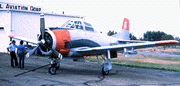
SDSM&T IAS T-28 Aircraft
The North Dakota Thunderstorm Project (NDTP) was a multi-agency cooperative research program designed to examine a number of facets of thunderstorm characteristics and evolution, including transport and dispersion, entrainment, cloud-ice initiation, storm structure, atmospheric chemistry, and electrification.
The NDTP was funded by the National Oceanic and Atmospheric Administration (NOAA) and the State of North Dakota through the Federal-State Cooperative Program in Atmospheric Modification Research (NOAA/AMP). Additional investigations were funded by the National Science Foundation, including a Research Experience for Undergraduates (REU) program which allowed students to be involved in the data collection effort.
Data collection began June 12 and continued through July 22, 1989. The research was conducted over the central and western plains of North Dakota, with project headquarters in Bismarck.
Data were collected using six instrumented aircraft, three Doppler weather radars, two atmospheric sounding systems, a Doppler acoustic sounder, and numerous other more conventional weather sensors.
Archived data and copies of the data inventory document are available by written request submitted to the Department of Water Resources, 1200 Memorial Hwy, Bismarck, ND 58504-5262. Though data are in the public domain, charges may be assessed for duplication.
The State of North Dakota through the Atmospheric Resource Board (now Department of Water Resources) and in association with the National Oceanic and Atmospheric Administration participated in the Federal/State Cooperative Program in Atmospheric Modification Research from its inception in 1980. At its conclusion in 1994, six states participated in the program: Arizona, Illinois, Nevada, North Dakota, Texas, and Utah.
This Federal/State Cooperative Program established a unique, national capability for advancing cloud physics research in atmospheric modification. This capability is considered to be of direct benefit to the nation's ability to understand and manage atmospheric water resources for agriculture, municipalities and industry. The expertise gained in cloud physics for atmospheric modification purposes is also applicable to understanding the role of clouds in global change.
North Dakota's program goals included: investigations of northern Great Plains thunderstorms to study the initiation of ice, the subsequent development of precipitation and hail, and storm turbulence, dynamics, entrainment and electrification.
Toward this end the North Dakota Atmospheric Resource Board coordinated four field research programs funded by the Atmospheric Modification Program and the State of North Dakota. They were: the 1985 and 1987 Field Research Programs in Dickinson, North Dakota, and the 1989 North Dakota Thunderstorm Project, and 1993 North Dakota Tracer Experiment both conducted in Bismarck, North Dakota.
On-site operational research for these programs were conducted in conjunction with and/or supported by the University of North Dakota's Center for Aerospace Sciences, the Institute for Atmospheric Sciences at the South Dakota School of Mines and Technology, NOAA's National Severe Storms Laboratory, Environmental Technologies Laboratory, Wave Propagation Laboratory, and the Cooperative Institute for Research in the Atmosphere at Colorado State University, the National Science Foundation, NASA, and the Canadian Atmospheric Environment Service.
A comprehensive list of all of the technical papers completed in the scope of DWR research activities.
Bloomer, M., and A.G. Detwiler, 1996: Implications from the North Dakota Tracer Experiment of 1993 for the glaciogenic seeding of supercooled convective clouds to suppress hail. J. Weather. Modif., 28, 86-91.
Boe, B.A., P.L. Smith, and R.E. Rinehart, 1994: The North Dakota Tracer Experiment: Studies of transport, dispersion, and hydrometeor development in cumuliform clouds. Preprints, World Meteorological Organization Sixth Scientific Conference on Weather Modification, May 26-June 2, 1994, PÆstum, Italy, 263-266.
Boe, B.A., 1994: The North Dakota Tracer Experiment: Tracer applications in a cooperative thunderstorm research program. J. Weather Modif., 26, 102-112.
Boe, B.A., 1992: Hail suppression in North Dakota. Preprints, AMS Symposium on Planned and Inadvertent Weather Modification, 5-10 January, Atlanta, GA. 58-62.
Boe, B.A., J.L. Stith, P.L. Smith, J.H. Hirsch, J.H. Helsdon, Jr., A.G. Detwiler, H.D. Orville, B.E. Martner, R.F. Reinking, R.J. Meitín, and R.A. Brown, 1992: The North Dakota Thunderstorm Project: A cooperative study of High Plains thunderstorms. Bull. Amer. Meteor. Soc., 73, 145-160. (external link)
Boe, B.A., H.L. Johnson, 1990: Destabilization antecedent to a tornadic northern High Plains mesoscale convective system: a case study. Preprints, AMS 16th Conference on Severe Local Storms, Kananaskis Park, Alberta, Canada. 538-541.
Boe, B.A., and J.A. Jung, 1990: The application of geostationary satellite imagery for decision-making in convective cloud seeding in North Dakota. J. Weather Modif., 22, 73-78.
Brown, R.A., and R.J. Meitín, 1994: Evolution and morphology of two splitting thunderstorms with dominant left-moving members. Mon. Wea. Rev., 122, 2052-2067. (external link)
Brown, R.A., C.A. Kaufman, and D.R. MacGorman, 2002: Cloud-to-ground lightning associated with the evolution of a multicell storm. J. Geophys. Res., 107 (D19)m 4397m doi:10.1029/2001JD000968. (external link)
Brown, R.A., and K.L. Torgerson, 2003: Interpretation of single-Doppler radar signatures in a V-shaped hailstorm: Part I - Evolution of reflectivity-based features. Natl. Wea. Dig., 27, 3-14. (external link, PDF)
Brown, R.A., and K.L. Torgerson, 2005: Interpretation of single-Doppler radar signatures in a V-shaped hailstorm: Part II - Evolution of updraft interactions with ambient midaltitude flow. Natl. Wea. Dig., 29, 65-80. (external link, PDF)
Chang, W.-Y., 1994: The North Dakota squall line on July 17, 1989: structure and microphysical analysis. M.S. Thesis, Dept. of Meteorology, South Dakota School of Mines and Technology, Rapid City, SD.
Chang, W.-Y., 1995: Radar and in-situ microphysical observations in a High Plains squall line. Preprints, 27th AMS Conference on Radar Meteorology, October 9-13, 1995, Vail, Colorado. 559-561.
Chou, H-Y, 1991: Doppler Radar Analysis of the 17 July 1989 Squall Line in North Dakota. M.S. Thesis, Dept. of Meteorology, South Dakota School of Mines and Technology, Rapid City, SD. 88 pages.
DeMott, P.J., J.L. Stith, and D.C. Rogers, 1995: Studies of cloud-active aerosols and ice initiation in North Dakota cumuli. Preprints, AMS Conference on Cloud Physics, 15-20 January 1995, Dallas, TX, 182-187.
DeMott, P.J., 1992: Quantifying ice nucleation by cloud seeding aerosols for use in conceptual and numerical cloud models. Preprints, AMS Symposium on Planned and Inadvertent Weather Modification, 5-10 January, Atlanta, GA. 148-155.
DeMott, P.J., D.C. Rogers, and L.O. Grant, 1992: Concerning primary ice nuclei concentrations and water supersaturations in the atmosphere. Preprints, 11th International Conference on Clouds and Precipitation, 17-21 August, Montreal, Canada, 284-287.
Dennis, A.S., P.L. Smith, and J.R. Miller, Jr., 1991: Comments on "Further exploratory evaluations of Grossversuch IV using hailpad data: Analysis of hail patterns and stratification by storm type seeding effect". J. Appl. Meteor., 30, 901-902. (external link)
Detwiler, A.G., P.L. Smith, and J.L. Stith, 1996: Studies of thunderstorm transport processes with aircraft using tracer techniques. Preprints, Second International Airborne Remote Sensing Conference and Exhibition, San Francisco, CA, 24-27 June 1996, p I-3 - I-9.
Detwiler, A.G., P.L. Smith, J.L. Stith, and D.A. Burrows, 1994a: Ice producing processes in a North Dakota cumulus cloud. Atmos. Res., 31, 109-122.
Detwiler, A.G., P.L. Smith, J.L. Stith, and D.A. Burrows, 1994b: Observations of microphysical evolution in a High Plains thunderstorm anvil. Atmos. Res., 33, 25-35.
Detwiler, A.G., P.L. Smith, and J.L. Stith, 1992: Observations of microphysical evolution in a High Plains thunderstorm. Preprints, 11th International Conference on Clouds and Precipitation, 17-21 August, Montreal, Canada, 260-263.
Detwiler, A.G., P.L. Smith, and J.L. Stith, 1992: Ice-producing processes in North Dakota clouds. Preprints, 13th International Conference on Nucleation and Atmospheric Aerosols, 24-28 August, Salt Lake City, UT, 305-308.
Detwiler, A.G., J.H. Helsdon, Jr., and D.J. Musil, 1990: Evolution of a band of severe storms. Preprints, AMS 7th Conference on Atmospheric Electricity, Kananaskis Park, Alberta, Canada, 705-709.
Detwiler, A.G., P.L. Smith, and D.J. Musil, 1990: T-28 participation in the 1989 North Dakota Thunderstorm Project. Report SDSMT/IAS/R-90/05, Institute of Atmospheric Sciences, South Dakota School of Mines and Technology, Rapid City, SD. 29 pages, appendices.
Eyerman-Torgerson, K.L., and R.A. Brown, 1995: The hail spike signature in the Carson, North Dakota hailstorm of 11-12 July 1989. Preprints, AMS 27th Conf. on Radar Meteorology, Vail, CO, 9-13 October 1995, 80-82.
Farley, R.D., and H.D. Orville, 1999: Whence large hail? Proceedings, Seventh WMO Scientific Conference on Weather Modification, 17-22 February 1999, Chiang Mai, Thailand. World Meteorological Organization Weather Modification Programme Report No. 31, Technical Document No. 936, 507-510.
Farley, R.D., T. Wu and H.D. Orville, 1992: Hail production in the 28 June 1989 case. World Meteorological Organization Third International Cloud Modeling Workshop, Toronto, Canada.
Farley, R.D., H. Chen, H.D. Orville, and M.R. Hjelmfelt, 1996: The numerical simulation of the effects of cloud seeding on hailstorms. Preprints, AMS 13th Conference on Planned and Inadvertent Weather Modification, Atlanta, GA, 23-30.
Frisch, A.S., B.W. Orr, and B.E. Martner, 1992: Doppler radar observations of the development of a boundary layer nocturnal jet. Mon. Wea. Rev., 120, 3-16. (external link)
Helsdon, J.H., Jr., 1990: Analysis of a high positive-flash frequency severe storm (28 June 1989) from the North Dakota Thunderstorm Project. Preprints, AMS Conference on Atmospheric Electricity, Kananaskis Park, Alberta, Canada. 744-747.
Hirsch, J.H., 1989: North Dakota Thunderstorm Project - 1989 Field Program Data Inventory. Bulletin 89-5, Institute of Atmospheric Sciences, South Dakota School of Mines and Technology, Rapid City, SD. 133 pages.
Hjelmfelt, M.R., H-Y Chou, R.D. Farley, and D.L. Priegnitz, 1992: Organization and development of a squall line in North Dakota as revealed by Doppler radar and numerical simulations. Preprints, 5th AMS Conference on Mesoscale Processes, 5-10 January, Atlanta, GA. 221-226.
Hjelmfelt, M.R., L.R. Johnson, A.G. Detwiler, D.L. Priegnitz, P.L. Smith, B.A. Boe, and R.F. Reinking, 1995: Radar analysis of the 15 July 1993 North Dakota record rainstorm. Preprints, AMS 27th Conf. on Radar Meteorology, Vail, CO, 9-13 October 1995, 571-573.
Huston, M.W., 1991: One- and Two-dimensional Model Results Compared with Observations of a North Dakota Cloud. M.S. Thesis, Dept. of Meteorology, South Dakota School of Mines and Technology, Rapid City, SD. 97 pages.
Huston, M.W., A.G. Detwiler, F.J. Kopp, and J.L. Stith, 1991: Observations and model simulations of transport and precipitation development in a seeded cumulus congestus cloud. J. Appl. Meteor., 30, 1389-1406. (external link)
Johnson, L.R., P.L. Smith, and P.W. Mielke, 1994: Some evaluations of the North Dakota Cloud Modification Project. Presented at the American Society of Agricultural Engineers 1994 International Summer Meeting, 19-22 June, Kansas City, MO, Paper No. 942017.
Johnson, L.R., and P.L. Smith, 1990: Estimation of convective rain volumes utilizing the area-time integral technique. Preprints, 8th AMS Conference on Hydrometeorology, Kananaskis Park, Alberta, Canada. 165-168.
Jung, J.A., 1990: Preliminary field experiments of SnomaxTM on cumulus mediocris clouds to artificially induce the production of ice particles. J. Wea. Modif., 22, 153-157 [non-reviewed].
Kaufman, C.A., and R.A. Brown, 1996: Relationship between cloud-to-ground lightning and the evolution of the Elgin storm on 11-12 July 1989. 18th Conf. On Severe Local Storms, AMS, 19-23 February 1996, San Francisco, CA. 483-487.
Klimowski, B.A., 1994: Initiation and development of rear inflow within the June 28-29 North Dakota meso-convective system. Mon. Wea. Rev., 121, 765-779.
Klimowski, B.A., and J.D. Marwitz, 1992: The synthetic dual-Doppler analysis technique. J. Atmos. Ocean. Tech., 9, 728-745. (external link)
Klimowski, B.A., and J.D. Marwitz, 1992: Developing flow structure of a severe squall line. Preprints, 5th AMS Conference on Mesoscale Processes, 5-10 January, Atlanta, GA, 227-232.
Klimowski, B.A., and J.D. Marwitz, 1990: Single Doppler analyses of a severe squall line and gust front. Preprints, 16th AMS Conference on Severe Local Storms, Kananaskis Park, Alberta, Canada. 252-255.
Knight, C.A., and L.J. Miller, 1990: First 5-cm radar echoes at low dBZ values in convective clouds. Preprints, AMS Conference on Cloud Physics, 23-27 July, San Francisco, CA. 716-721.
Kopp, F.J., and H.D. Orville, 1994: The use of a two-dimensional, time-dependent cloud model to predict convective and stratiform clouds and precipitation. J. Wea. Forecast., 9, 62-77. (external link)
Kopp, F.J., and H.D. Orville, 1990: The use of a cloud model to predict convective and stratiform clouds and precipitation. Preprints, 16th AMS Conference on Severe Local Storms, Kananaskis Park, Alberta, Canada. 322-327.
Kopp, F.J., H.D. Orville, J.A. Jung, and R.T. McNider, 1990: A parameterization of the radiation heating at the surface in a numerical cloud model. Preprints, AMS Conference on Cloud Physics, 23-27 July, San Francisco, CA. J81-J84.
Martner, B.E., 1997: Vertical Velocities in a Thunderstorm Gust Front and Outflow. Journal of Applied Meteorology, 36, 615-622. (external link)
Martner, B.E., J.D. Marwitz, and R.A. Kropfli, 1992: Radar observations of transport and diffusion in clouds and precipitation using TRACIR. J. Atmos. Ocean. Tech., 9, 226-241. (external link)
Martner B.E., 1990: Radar observation of transport and diffusion of chaff in a stratus cloud. Preprints, AMS 9th Symposium on Turbulence and Diffusion, 30 April - 3 May, Roskilde, Denmark. 115-118.
Martner, B.E., and J.D. Marwitz, 1990: Transport and diffusion of chaff in a convective cloud. Preprints, AMS Conference on Cloud Physics, 23-27 July, San Francisco, CA. 722-729.
Meitín, R.J., and R.A. Brown, 1990: A dual-Doppler analysis of North Dakota thunderstorms using airborne and ground-based radars. Preprints, 16th AMS Conference on Severe Local Storms, Kananaskis Park, Alberta, Canada. 225-230.
Meitín, R.J., R.A. Brown, and J.G. Meitín, 1991: Comparison of airborne dual-Doppler and airborne/ground-based dual Doppler analyses of North Dakota thunderstorms. Preprints, AMS 25th International Conference on Radar Meteorology, Paris, France. 474-477.
Musil, D.J., A.G. Detwiler, D.L. Priegnitz, M.R. Hjelmfelt, and P.L. Smith, 1993: Radar and aircraft investigation of a North Dakota thunderstorm complex (10 July 1989). Preprints, AMS 26th International Conference on Radar Meteorology, 24-28 May, Norman, OK. 91-93.
Nair, U.S., 1991: Modeling and Observational Study of the 28 June 1989 Case from the North Dakota Thunderstorm Project. M.S. Thesis, Dept. of Meteorology, South Dakota School of Mines and Technology, Rapid City, SD. 153 pages.
Orr, B.W., 1990: Boundary Layer Momentum Budgets as Determined from a Single Scanning Doppler Radar. M.S. Thesis, Department of Atmospheric Science, Colorado State University, Fort Collins, CO. 116 pages. (external link)
Orville, H.D., F.J. Kopp, R.D. Farley, and G.M. Kraaijenbrink, 1993: The use of cloud models for the prediction of local cloud and precipitation conditions. Preprints, 13th AMS Conference on Weather Analysis and Forecasting, 2-6 August, Vienna, VA, 103-106.
Orville, H.D., and N.C. Knight, 1992: An example of a Research Experience for Undergraduates. Bull. Amer. Meteor. Soc., 73, 161-167. (external link)
Orville, H.D., 1992: A review of the theoretical developments in weather modification in the past 20 years. Preprints, AMS Symposium on Planned and Inadvertent Weather Modification, 5-10 January, Atlanta, GA. 35-41.
Orville, H.D., R.D. Farley, and F.J. Kopp, 1991: The simulation of cloud seeding effects using numerical cloud models. J. Wea. Modif., 23, 17-26.
Orville, H.D., R.D. Farley, and F.J. Kopp, 1990: The simulation of cloud seeding effects using numerical cloud models. Presented at the annual meeting of the American Association for the Advancement of Science, 15-20 February, New Orleans, LA.
Orville, H.D., F.J. Kopp, U.S. Nair, J.L. Stith, and R.E. Rinehart, 1990: On the origin of ice in strong convective cells. Preprints, AMS Conference on Cloud Physics, 23-27 July, San Francisco, CA. 16-20.
Priegnitz, D.L., 1995: IRAS: Software to display and analyze WSR-88D radar data. Preprints, AMS Conf. on IIPS for Meteorology, Oceanography, and Hydrology, 15-20 January 1995, Dallas, TX, 197-199.
Priegnitz, D.L., and M.R. Hjelmfelt, 1993: SUN-IRAS: An improved package for the display and analysis of weather radar data. Preprints, AMS 26th International Conference on Radar Meteorology, 24-28 May, Norman, OK. 335-337.
Priegnitz, D.L., 1991: The interactive radar analysis software (IRAS) package. Preprints, 7th AMS International Conference on Interactive Information Processing Systems, New Orleans, LA. 173-176.
Reinking, R.F., and B.E. Martner, 1996: Feeder-cell ingestion of seeding aerosol from cloud base determined by tracking radar chaff. J. Appl. Meteor., 35, 1402-1415. (external link)
Reinking, R.F., B.E. Martner, and B.W. Orr, 1994: Cloud ingestion of seeding material determined by tracking chaff with dual-polarization radar. Preprints, Sixth WMO Conf. on Weather Modification, 27 May - 2 June 1994, PÆstum, Italy.
Reinking, R.F., and R.J. Meitín, 1993: Vortical circulations within the anvil of a High Plains thunderstorm. Preprints, AMS 17th Conference on Severe Local Storms, St. Louis, MO, 242-246. Reinking, R.F., R.J. Meitín, F.J. Kopp, H.D. Orville, and J.L. Stith, 1992: Fields of motion and transport within a sheared thunderstorm. Atmos. Res., 27, 197-226.
Reinking, R.F., R.J. Meitín, F.J. Kopp, and H.D. Orville, 1991: Fields of motion and transport within a sheared thunderstorm. Journada Internacíonales Sobré Agricultura y Modificacíon Atmosferica, 12-15 March, Zamora, Spain.
Reinking, R.F., J.L. Stith, and R.J. Meitín, 1990: Airborne Doppler radar and in situ studies of the transport of ozone and other constituents in feeder cells and anvils. Preprints, AMS Conference on Cloud Physics, 23-27 July, San Francisco, CA. 698-705.
Rinehart, R.E., 1996: Runs of Hail Days during a Hail Season. Preprints, AMS 13th Conference on Planned and Inadvertent Weather Modification, Atlanta, GA., 28 January - 2 February 1996, 91-96.
Rogers, D.C, P.J. DeMott, and L.O. Grant, 1994: Concerning primary ice nuclei concentrations and water supersaturations in the atmosphere. Atmos. Res., 33, 151-168.
Ross, C.S., 1992: Lightning Observations and Electrical Modeling Results of the 28 June 1989 Case Study for the North Dakota Thunderstorm Project. M.S. Thesis, Dept. of Meteorology, South Dakota School of Mines and Technology, Rapid City, SD. 90 pages.
Scala, J.R., B.S. Ferrier, and W.-K. Tao, 1995: Real-time forecasting of convection during the North Dakota Tracer Experiment using the Goddard Cumulus Ensemble model. Preprints, AMS 14th Conf. on Weather Analysis and Forecasting, 15-20 January 1995, Dallas, TX,
Smith, P.L., L.R. Johnson, D.L. Priegnitz, B.A. Boe, and P.W. Mielke, Jr., 1997: An exploratory analysis of crop-hail insurance data for evidence of cloud seeding effects in North Dakota. J. Appl. Meteor., 36, 463-473. (external link)
Smith, P.L., T.A. Bowen, A.G. Detwiler, J.L. Stith, B.E. Martner, and R.F. Reinking, 1996: Summary of some transport and dispersion experiments using a gaseous tracer and radar chaff. Preprints, 12th International Conference on Clouds and Precipitation, p 514-517.
Smith, P.L., 1995: On the minimum useful elevation angle for weather surveillance radar scans. Preprints, AMS 27th Conf. on Radar Meteorology, Vail, CO, 9-13 October 1995, 669-671. (external link)
Smith, P.L., B.A. Boe, R.A. Brown, P.J. DeMott, B.A. Klimowski, B.E. Martner, H.D. Orville, R.F. Reinking, and J.L. Stith, 1994: Some results from the North Dakota Thunderstorm Project. Preprints, Sixth WMO Conf. on Weather Modification, 27 May - 2 June 1994, PÆstum, Italy, 93-96.
Smith, P.L., L.R. Johnson, D.L. Priegnitz, and P.W. Mielke, 1994: Statistical Evaluations of the North Dakota Cloud Modification Project. Preprints, Sixth WMO Conf. on Weather Modification, 27 May - 2 June 1994, PÆstum , Italy, 281-284.
Smith, P.L., J.L. Stith, A. Borho, R.F. Reinking, and B.E. Martner, 1993: North Dakota Tracer Experiment investigates cloud transport processes. The Earth Observer, 5, No. 6, 34-36.
Smith, P.L., 1993: An update on weather radar system sensitivity. Preprints, AMS 26th International Conference on Radar Meteorology, 24-28 May, Norman, OK. 384-386.
Smith, P.L., 1993: Cloud radar sensitivity versus operating wavelength. GEWEX Topical Workshop on Cloud Profiling Radar, 29 June - 1 July, Pasadena, CA.
Smith, P.L., Z. Liu, and J. Joss, 1993: A study of sampling variability effects in raindrop size distributions. J. Appl. Meteor., 32, 1259-1269.
Smith, P.L., 1992: Hail suppression activity around the world. Preprints, AMS Symposium on Planned and Inadvertent Weather Modification, 5-10 January, Atlanta, GA. 28-34.
Smith, P.L., H.D. Orville, B.A. Boe, and J.L. Stith, 1992: A status report on weather modification research in the Dakotas. Atmos. Res., 28, 271-298.
Smith, P.L., H.D. Orville, B.A. Boe, and J.L. Stith, 1991: Weather modification in the Dakotas. Journada Internacíonales Sobré Agricultura y Modificacíon Atmosferica, 12-15 March, Zamora, Spain. 71-82.
Smith, P.L., H.D. Orville, and B.A. Boe, 1991: An overview of the North Dakota Thunderstorm Project. Preprints, 2nd Yugoslav Conference on Weather Modification, April, Mavrovo, Yugoslavia. Volume I, 16-24. Smith, P.L., Z. Liu, and J. Joss, 1991: Apparent Z-R relationships arising from sampling variability in raindrop size observations. Preprints, AMS 25th International Conference on Radar Meteorology, Paris, France. 760-763..
Smith, P.L., and Z. Liu, 1990: Some statistics of sampling from exponential particle size distributions. Preprints, AMS Conference on Cloud Physics, 23-27 July, San Francisco, CA. 367-370.
Stith, J.L., J. Scala, R.F. Reinking, and B.E. Martner, 1996: Combined use of three techniques for studying transport and dispersion in cumuli. J. Appl. Meteor., 35, 1387-1401. (external link)
Stith, J.L., R.J. Zerr, C.A. Grainger, and R.E. Rinehart, 1995: Microphysical characteristics of clouds in North Dakota: implications for seeding decisions. Preprints, AMS 13th Conference on Planned and Inadvertent Weather Modification, Atlanta, GA., 28 January - 2 February 1996, 85-90.
Stith, J.L., 1995: In situ measurements and observations of cumulonimbus mamma. Mon. Wea. Rev., 123, 907-914. (external link)
Stith, J.L., J. Scala, R.F. Reinking, and B.E. Martner, 1995a: Three techniques for studying the transport and dispersion of seeding material. Preprints, Sixth WMO Conf. on Weather Modification, 27 May - 2 June 1994, PÆstum , Italy, 405-408.
Stith, J.L., and J.R. Scala, 1993: Summer storms provide abundant research opportunities for the North Dakota Tracer Experiment. The Earth Observer, 5, 28-30.
Stith, J.L., D.A. Burrows, and P.J. DeMott, 1993: Initiation of ice: Comparison of numerical model results with observations of ice development in a cumulus cloud. Atmos. Res., 32, 13-30.
Stith, J.L., 1992: New techniques for studying the microphysical effects of cloud seeding. Preprints, AMS Symposium on Planned and Inadvertent Weather Modification, 5-10 January, Atlanta, GA. 156-160.
Stith, J.L., D.A. Burrows, and P.J. DeMott, 1992: Initiation of ice in clouds: Comparison of numerical model results with observations. Preprints, 11th International Conference on Clouds and Precipitation, 17-21 August, Montreal, Canada, 196-199.
Stith, J.L., 1992: Observations of cloud top entrainment in cumuli. J. Atmos. Sci., 49, 1334-1349. (external link)
Stith, J.L., 1990: Observations of cloud top entrainment using gaseous tracer techniques. Preprints, AMS Conference on Cloud Physics, 23-27 July, San Francisco, CA. 532-535.
Stith, J.L., A.G. Detwiler, R.F. Reinking, and P.L. Smith, 1990: Investigating transport, mixing, and the formation of ice in cumuli with gaseous tracer techniques. Atmos. Res., 25, 195-216.
Stoppkotte, J.W., 1993: A North Dakota first-echo analysis. M.S. Thesis, Dept. of Meteorology, SD School of Mines and Technology, Rapid City, SD. 94 pages.
Stoppkotte, J.W., and P.L. Smith, 1993: What is a first echo? Preprints, AMS 26th International Conference on Radar Meteorology, 24-28 May, Norman, OK. 576-578.
Torgerson, K.L., and R.A. Brown, 1996: Radar signatures of updrafts within the Carson, ND hailstorm of 11 July 1989. 18th Conf. On Severe Local Storms, AMS, 19-23 February 1996, San Francisco, CA, 81-85.
Zhang, S., 1991: Two-dimensional Model Transport simulation in Clouds Compared with Observations. M.S. Thesis, Dept. of Meteorology, South Dakota School of Mines and Technology, Rapid City, SD. 75 pages.